
Google is your friend: Google Earth

by Jim Thornhill
Americans love experiences. We go to Starbucks, not just because they have good coffee, but because it’s cool to be seen with a Starbucks cup, because it’s a comfortable place to chill, or a nice place to meet with friends or associates. Almost 6 million people, in a normal year, visit the Grand Canyon for the experience of seeing that awesome sight and reconnecting with nature. We love experiences.
As Family Historians we are no different. We all look for data to tell us when and where our ancestors lived, but when we can see the things they saw, live through what they experienced, well, that takes our family history to a whole new level!
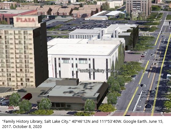
Google Earth can do this for you. Have you ever seen the township and range on your ancestor’s property deeds? Have you ever seen the township and range after searching on the BLM website? Have you ever seen your ancestor’s street name on the census? Have you ever wondered what the view was like from your ancestor’s farm or front door? Google Earth can answer these questions and more.
There are two versions, Google Earth and Google Earth Pro. Google Earth is web-based, meaning you can access it from anywhere, but it doesn’t have as many bells and whistles as Google Earth Pro. Google Earth Pro is the desktop version.
A book would be necessary to explore the tools in Google Earth, so I am going to point you to the sites where you can learn for yourself. The first stop is to visit Google Earth Versions to download or access either version. Then visit YouTube to watch a tutorial on how to get started. There are many, but this one, Basic Overview of Google Earth Pro is pretty good.
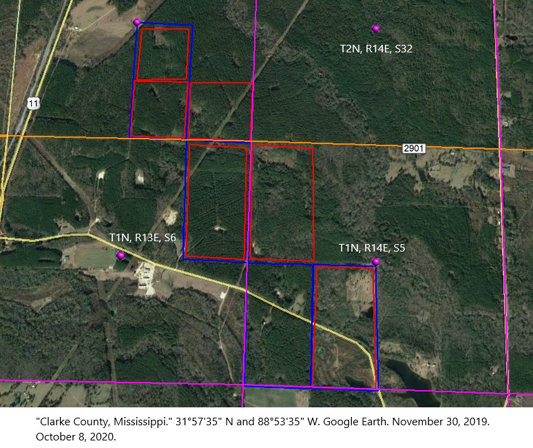
If you are using Google Earth Pro you can use Earth Point townships to overlay a grid of townships and ranges over Google Earth. If you know the township and range of your ancestor’s land, you can locate it using this system. Once you know the location, you can draw the boundaries of your ancestor’s property and even color code them for different family members, type of transactions, etc.
Another overlay I use regularly are the topographic maps. Go to Earth Point topo to download the file for the topo overlay.
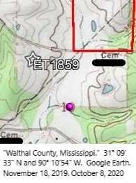
Topographic maps help me in my genealogy because they show the terrain and landmarks. There may be a cemetery near where your ancestors lived on a topographic map that is not marked by road signs. These maps will also tell you if your ancestors land was swampy, a forest, or perhaps there was a mine on your ancestor’s property. These are all things I want to know about my family. If you get stuck with any of these tools, help can be found on YouTube or on each site.
Start using Google Earth today to learn where your ancestors lived and worked. Once you know where, plan a visit. Walk in their footsteps, search their land. There’s no telling what you will find, and you will never think of them the same!