
a.k.a. “Paupers at Letot Cemetery“, “Dallas Paupers Cemetery” and “City Paupers Cemetery“
This cemetery was used by the City of Dallas from 1932 until 1978 as a burial ground for unclaimed or unidentified remains and for individuals unable to afford plots in private cemeteries. As a result of the large transient population in the 1930’s, a great many of the listings are from that decade.
It is estimated that 2060 – 2084 burials occurred at this cemetery.
Location & Access
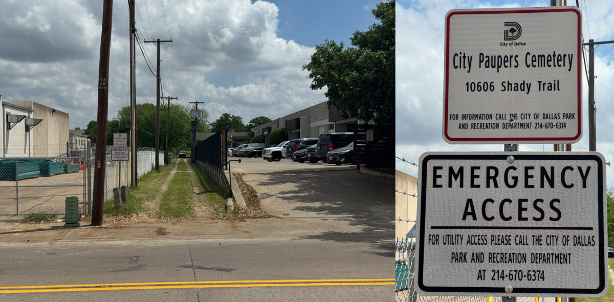
On Shady Trail between Northwest Highway and Walnut Hill. Located on the East side of the road between Freewood Drive and Myrtle Springs Avenue.
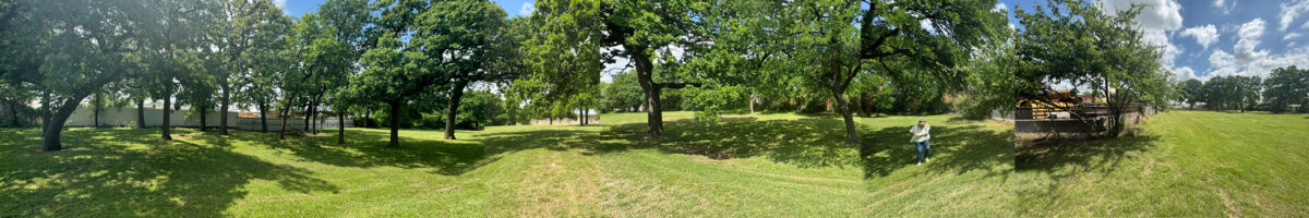
Access is via a long grassy lane accessible from Shady Trail. You can drive down the lane directly onto the cemetery property. There are no gates, locks or access restrictions.
The property appeared to be mowed and well maintained in April 2026.
- Address: 10606 Shady Trail, Dallas TX 75220
- MAPSCO Reference: 23-S
- GPS Coordinates: 32.869624, -96.887740
- Legal Description (From https://maps.dcad.org/prd/dpm/)
- Parcel ID 00000600502000000: BLK 6471 3.2429 ACS INSIDE E OF BLK 6472,S OF FREEWOOD DR (10621 HARRY HINES BLVD)
- Map Grid: 23-S (DALLAS)
- Account Type: Commercial
- Owner: City of Dallas
History/Background
The city purchased the land for this cemetery from Forest Lawn Cemetery and Mausoleum on 16 February 1932 [Deed Book 1748, pg 42-43]. For a while both paupers from both the city and the county were interred in this cemetery.
The cemetery reportedly originally extended from Harry Hines Boulevard to Shady Trail road. Businesses have since been established on the eastern and western portions of the property.
The use of “Letot” in some of the aliases was attributed to the location of the cemetery (near the early Dallas settlement of Letot). The Old Letot Family Cemetery is located further to the North at 10740 Shady Trail Lane.
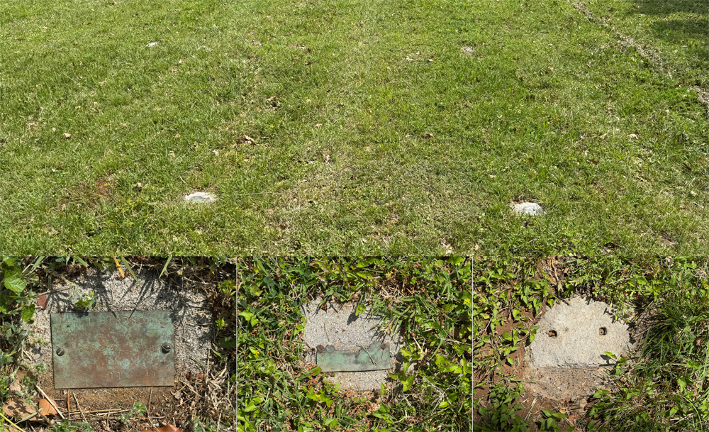
Each grave was marked with a small metal marker set into a small concrete pad. In April 2026 most of the markers appear to have settled into the ground. Many are still visible but the metal signs are showing signs of deterioration or are simply missing.
A few graves are now marked with contemporary grave stones that have obviously been placed since burials ended in 1978.
Dallas Genealogical Society volunteers read the existing markers in 1989 and reviewed city records. For some entries, dates of death were extracted from the Texas Death Certificate Index; these entries were followed by the certificate number. Spellings are as they appeared either on city records or on the grave marker.
The 1989 published survey has been updated by comparing the list with scanned images of Texas Death Certificates on FamilySearch.org and Ancestry.com. At times this resulted in a different name or date. It appears that the names on the markers aren’t always the person who is buried there. For example, parent’s first name instead of the child’s. Dates on the markers may be the burial date rather than the death date.
For more information, read Dallas City Cemetery – a brief history in our blog.
Restoration/Preservation Activities
Utilizing maps of the cemetery and enlisting the help of hobbyist metal detectorists organizations, Daniel Babb and other volunteers have been able to locate about 2000 graves and 500 loose name plates. Combined with the death certificates research, Daniel has accounted for 99.9% of the estimated 2060 burial locations.
Additional Information
- Dallas City Cemetery/City Paupers Cemetery: A – L – https://freepages.rootsweb.com/~jwheat/history/cemeteries/citypaupercem/citypauperscemal.html
- Dallas City Cemetery/City Paupers Cemetery: M – Z & Unknowns – https://freepages.rootsweb.com/~jwheat/history/cemeteries/citypaupercem/citypauperscemmz.html
- Dallas City Cemetery – https://dallaspioneer.org/dallas-city-cemetery/
- A Watershed Moment for Dallas City Cemetery – https://www.dallasrediscovered.com/p/a-watershed-moment-for-dallas-city
- East Dallas adventurist helps unearth and restore an 85-year-old pauper’s cemetery, hidden near Love Field – https://lakewood.advocatemag.com/paupers-cemetery-love-field-history/
- Dallas City Cemetery – Next Steps – https://www.dallasrediscovered.com/p/dallas-city-cemetery-next-steps